Paper Lochs, Real Fish: How Old Maps Put You on Better Trossachs Banks

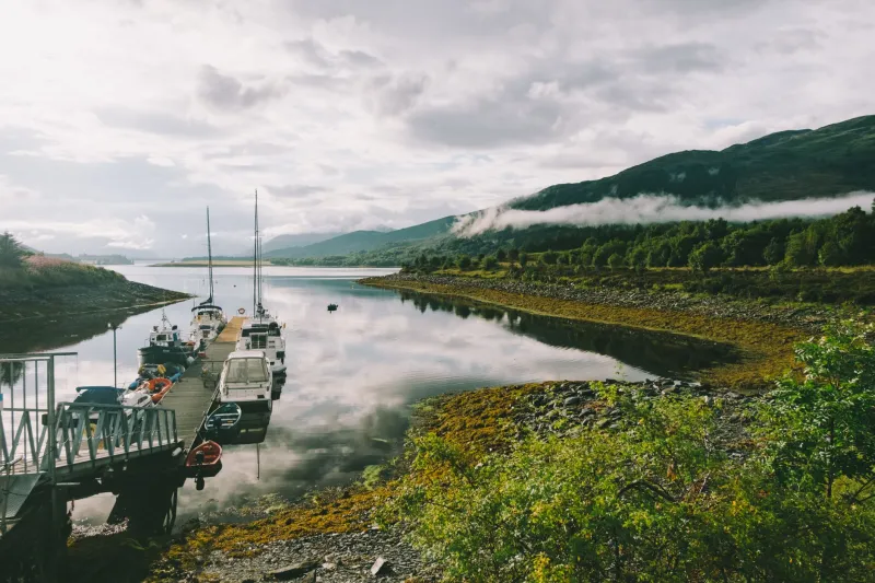
There is a particular kind of Trossachs afternoon where the loch is drawn down, the bank is a muddier shade of grey, and you find yourself staring at a line of old fence posts marching straight into the water. Those posts are a clue. They are also, if you know where to look, already drawn on a map.
Old maps are not just wallpaper for a fishing bothy. For bank anglers in the Trossachs, they are a practical tool. They show where walls, fences, roads and burns used to run before a dam was built or a loch was raised. Those features still sit under the surface, and they still influence where pike, perch and trout will hold. The trick is learning to read them without treating them as a promise of access.
Why a drowned fence matters to a fish
A submerged fence line is structure. Weeds collect along it, small fish shelter beside it, and predators patrol the edges. The same goes for an old field wall, a road embankment or a stone ford. In lochs that get drawn down in winter — Venachar, Achray, Drunkie and parts of the Katrine catchment — these features become visible or nearly visible when the water is low. That is useful for two reasons: you can see them, and you can find them again when the water comes back up.
Stream channels are the other big one. A burn that once entered the loch at a certain point may now be submerged, but its old channel often persists as a deeper groove. Fish use those grooves like lanes. On a flat, featureless bank, an old channel can be the difference between a blank and a bend in the rod.
Where to find the maps without paying a fortune
The National Library of Scotland's online map collection is the obvious starting point. The first-edition six-inch Ordnance Survey sheets and the later 1:25,000 and 1:10,000 revisions are free to view. Look for the loch at its pre-reservoir level if you can, then compare it with the modern sheet. Reservoir histories — often held by Scottish Water, the Forestry and Land Scotland office or local heritage groups — can tell you when the water was raised and by how much. Old estate plans, sometimes lodged with the National Records of Scotland, are patchier but can show drainage cuts and boat slips that never made it onto the OS.
A practical workflow is simple. Pick a loch. Download the oldest clear OS sheet that covers it. Mark every fence, wall, road and burn within casting distance of the bank. Then overlay that on a modern map or satellite image. The features that still show as a faint line at low water are the ones worth fishing.
From paper to bank: a few Trossachs examples
The west end of Loch Venachar is a good classroom. Drawdown exposes old field boundaries and the stumps of a former road edge. In winter, when the water is low, you can often find the line of an old wall running out from the shore. Fish it from the bank with a slow-moving lure or a deadbait on a simple running lead. Do not wade out to it. The mud is deeper than it looks, and the wall itself is loose.
Loch Drunkie, being a reservoir, is another one. Old maps show tracks and enclosures that are now underwater for much of the year. When the level drops, those tracks reappear as gravel lines. They are tempting to follow, but they can end in soft ground or a sudden drop-off. Treat them as fish-holding features, not footpaths.
On Loch Achray, the old stream channels at the east end are worth a look on a cold afternoon. Perch often sit in the deeper grooves, and pike are not far away. A small jig or a dropshot bait worked slowly along the channel edge can be deadly. Again, the map tells you where to start, not where to stand.
The access trap: old routes are not current rights
This is the part where a lot of anglers get themselves into bother. An old map might show a track running to the shore. That does not mean you can drive it, walk it or park at the end of it today. Tracks can cross private land, be overgrown, or have been diverted. A right of way on a 1900s sheet is not automatically a right of way now.
Before you go, check the current access situation. Forestry and Land Scotland land has its own rules. Loch Katrine has its own permit system and access points. Some estates are relaxed about bank fishing; others are not. The safe approach is to assume nothing and ask. The Scottish Outdoor Access Code gives you a framework, but it does not override a locked gate or a signed diversion.
Also, do not rely on old maps for parking. A lay-by that existed in 1950 may be a passing place now, or a bog. Park where it is legal and obvious. Walk the extra ten minutes.
A caution about mud and metal
Drawdown banks are not just uneven. They are soft. Old fence wire, broken glass and rusted metal often lurk just under the surface of the mud. Wear boots with decent grip, carry a stick to test the ground, and never wade out to a feature you have only seen on a map. If a fence line is visible at the water's edge, fish it from a rod length back. You do not need to stand on it.
The map is a starting point, not a guarantee
Old maps will not catch fish for you. They will, however, narrow down the bank. They turn a random cast into a considered one. On a short winter day, that matters. So next time the loch is low, take a look at the sheet before you go. Find the drowned fence, the old road edge, the forgotten burn. Then fish it sensibly, legally, and with one eye on the mud.